Insurability Assessments
Artio provides free, confidential insurability assessments for project developers to help strengthen their position with buyers and financiers from as early as the feasibility stage. Our assessments indicate whether a project is insurable, and if not, provide clear, actionable feedback on how to reduce risk. For insurable projects, this insight can be used in marketing materials and investor conversations, so we’re ready to fast-track quotes when buyers are interested.
-
The assessment is designed to support funding conversations by offering a clear, preliminary view of how the project aligns with insurance requirements. This can help address investor or lender questions early, reducing the need to seek additional insurance information during due diligence and allowing insurance to facilitate rather than delay capital deployment.
However, the assessment must not be presented as a guarantee of coverage, an offer of insurance, or a binding quote. All references to Artio’s insurance products must be factual, balanced, and consistent with relevant regulatory guidance.
-
You simply upload your project documents to our platform using the link below then after the assessment is complete you will receive:
Insurability Letter (pending approval)
Insurability Assessment
Your letter can be used to support funding conversations and the assessment will provide outputs on where the risks sit from an insurance view.
-
Our innovative risk engine can provide a full insurability assessment in as little as 2 days* to support live transactions but typically take 2 weeks.
*This is subject to complexity of project and provision of all required information
-
Typically the best time to run the assessment is 4-6 weeks prior to raising capital for your project however we can support at any time. We find that most projects have the required documents by feasibility stage.
Artio Risk Engine Insights
Carbon Modelling
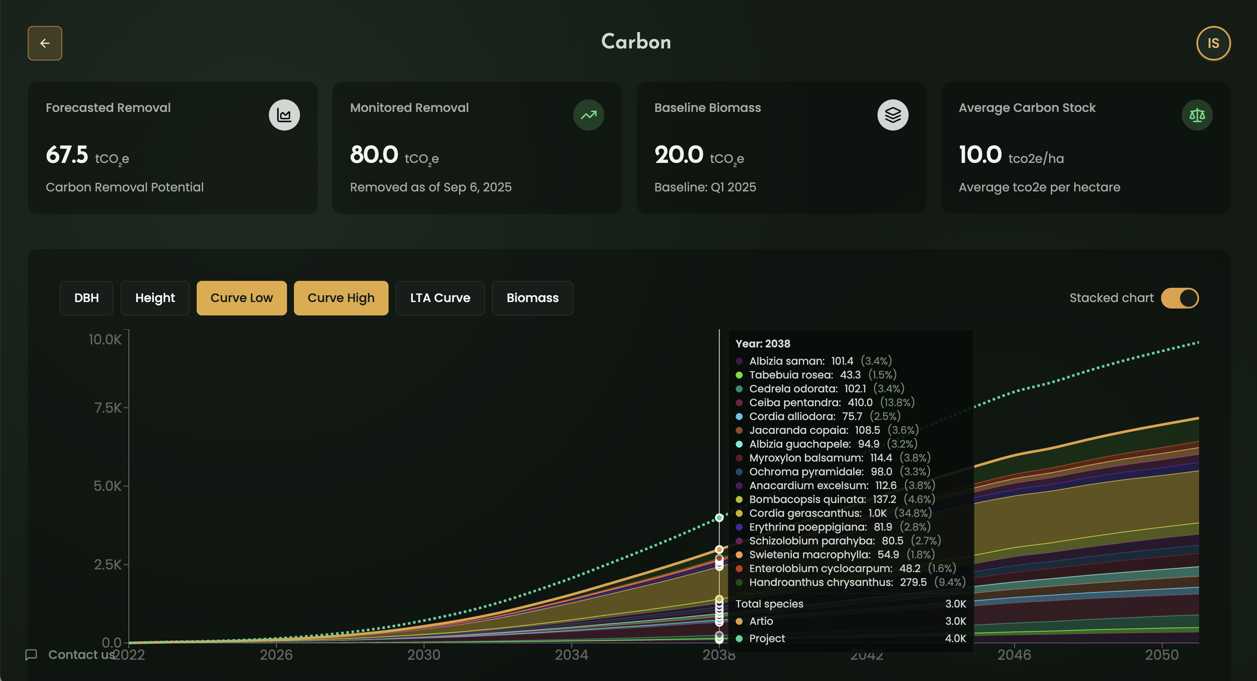
Artio develops fully independent carbon curves by calculating the unique lifecycle analysis for every project type, from scientific tree growth rates to pyrolysis and weathering outputs. Our models move beyond generic estimates, providing high-fidelity sequestration and delivery projections tailored to specific methodologies. This rigorous, science-first approach ensures that our modelling is backed by a precise carbon accounting framework.
Biomass Monitoring
We leverage deep learning models trained on global biomes and LiDAR data to generate high-resolution, 10-metre biomass maps. By correlating Sentinel-2 satellite imagery with digital elevation and land cover data, we achieve granular, spatially accurate insights across any project site. This scalable remote-sensing framework provides a consistent "ground truth" for forest structures and vegetation density worldwide.
Climate Risk Modelling
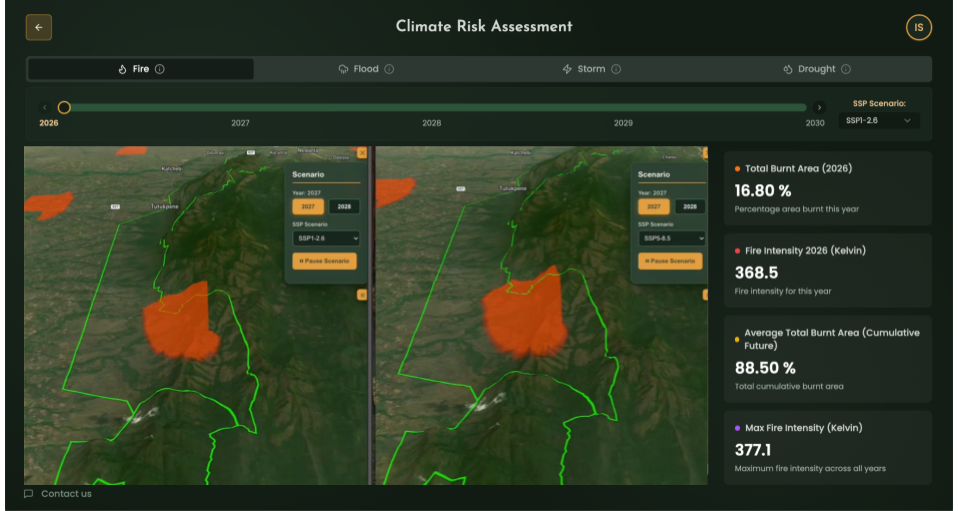
We create custom impact functions for every project type to quantify the specific vulnerabilities of carbon assets to fire, flood, drought, and storm risks. These functions are integrated directly into our carbon curves, allowing us to stress-test project performance against escalating environmental volatility. By modeling climate risk at the project level, we translate complex meteorological data into actionable insights.
FAQs
-
Yes, you may share the insurability assessment with prospective investors or banks, provided it is presented accurately and in the appropriate context. The assessment is designed to support funding conversations by offering a clear, preliminary view of how the project aligns with insurance requirements. This can help address investor or lender questions early, reducing the need to seek additional insurance information during due diligence and allowing insurance to facilitate rather than delay capital deployment.
However, the assessment must not be presented as a guarantee of coverage, an offer of insurance, or a binding quote. All references to Artio’s insurance products must be factual, balanced, and consistent with relevant regulatory guidance.
-
Yes. All information shared with Artio during the assessment process is treated as strictly confidential and will not be disclosed without your consent, unless required by law.
-
This insurability assessment is intended for informational purposes only and does not constitute an offer of insurance, a guarantee of coverage, or a binding quote. It reflects Artio’s preliminary view of a project’s insurability based on the information provided, and should not be interpreted as a confirmation of eligibility or a commitment to insure.
-
Our innovative risk engine can provide a full insurability assessment in as little as 2 days* to support live transactions but typically take 2 weeks.
*This is subject to complexity of project and provision of all required information
-
Our insurance partners are global leaders in insurance and will often have already been approved by internal insurance teams for project finance lenders.
Tokio Marine HCC is a global specialty insurance group known for its expertise in niche and high-risk markets, holding an AA- Fitch rating and reporting annual premiums of over $8 billion.Markel Corporation, a diversified specialty insurer covering industries like M&A, marine, and cyber, has an A+ Fitch rating with annual premiums exceeding $10 billion.
Apollo Syndicate Management, a Lloyd’s managing agent providing flexible underwriting solutions across multiple lines, operates under Lloyd’s market ratings, including an AA- Fitch rating.
-
Artio's™ Risk Engine has been created specifically to understand all the risks carbon projects face from day one.
Built with market specific knowledge over years of assessing quality, geospatial analysis and bringing in a wider understanding of project finance alongside wider risk modelling we use the model to power our insurance and look forward to what is realistically achievable in terms of projected delivery or risk areas for reversal risk.
-
If your project is assessed as not insurable, Artio will provide specific feedback on the issues identified and suggestions for how risk may be reduced to support future insurability.